

STANDALONE TRAIL MAP
TRAIL INFORMATION

Details
| Status: | Open |
| Difficulty: | Advanced |
| Uses: | Mt Biking & Hiking & Equestrian & Motorcycle & eBikes |
| Length: | 5.8 miles |
| Start: | 7,943' |
| End: | 6,028' |
| Min: | 6,028' |
| Max: | 7,943' |
| Gain: | 263' |
| Loss: | -2,179' |
| fly your trail in 3D | |
 |
Google Earth KML file
Download KML file above, open in Google Earth to see this trail in 3D! |
| don't get lost |
| GPX file (right click to download)
Download GPX file above, upload the track to your GPS or smartphone and you'll always know where you are!! |
Trail Info
REMARKS:
Most trails are dry and open. The WRTC/KRD volunteer moto crew has been clearing trails of deadfall. Sections of snow exist at higher elevations. If you encounter extended wet and muddy conditions, turn back and choose a different trail. Wildflower viewing is reported to be great and getting even better in Greenhorn.
June 18, Forest Service Reports: A sheep band is in the Limekiln Gulch up high grazing towards Cow Creek Trail (Trail 180). This band will graze in Cow Creek before returning to the lower end of Limekiln.
Trailhead Forecast
Description / Access Information
Mahoney Trail #821: The mid-elevation to higher portions of this trail contain areas with lots of loose rock and other technical challenges. The lowest portion is the least demanding section of the trail. It is used as part of several popular Greenhorn day hikes and rides.
The Greenhorn Gulch drainage, which includes Cow Creek, Lodgepole Gulch, Mahoney Gulch, Greenhorn Creek, and Imperial Gulch has the highest concentration of multi-use trails in the valley. Much of the northern half of the drainage was burned quite severely during the Castle Rock Fire in 2007. The 2013 Beaver Creek Fire was another big hit to the drainage.
Use extra caution when planning outings in areas impacted by the recent fires. Storms can create flash floods, debris flows, and falling timber. Check the weather and keep your eye on the skies when you are headed out for a hike or ride. Travel is not recommended in burned areas when threatening weather conditions exist. Burned, standing trees can come down in any weather, but when windy conditions develop the situation becomes especially dangerous. When in doubt stay out.
The trails pass through a wide variety of terrain, from dense forest to open grass and flower-covered slopes. The area also includes meandering ridge lines and, burned/limbless forests recovering from the 2013 fire.
The interconnected nature of the Greenhorn trails allows for a wide variety of loops; all of the drainages are linked along the western divide. Some loops are long, but there are several shorter options available too. Out-and-back hikes are also a great option on both the Greenhorn and Imperial Gulch trails.
The motorcycle community was instrumental in helping to fund the development of the Greenhorn trail network. Funds from the Idaho Department of Parks and Recreation paid for a lot of motorized specific trail development in the late 70s and early 80s. As a result, all of the trails in Greenhorn Gulch are multi-use and open to motorcycles. Please respect each other out there and enjoy this wonderful system of trails.
Directions: From Ketchum, drive south on Highway 75 to the East Fork stoplight (5.5 mi). Turn right onto Greenhorn Gulch Road and follow it to the parking lot (3.7 mi).
For more detailed descriptions, topo maps, and information on the history, geology, and wildflowers of the Wood River Valley pick up a copy of Exploring Sun Valley online or find it at one of several local shops.
Photos
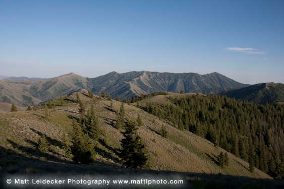 |
| The long view into Greenhorn Gulch |


