HERE IS MEASURE
TAP TRAIL FOR MORE INFO
STANDALONE TRAIL MAP
TRAIL INFORMATION
Scroll to detailed trail information
Hidden Valley
// track pieces: 236, // elevation pieces: 236
Click to Reverse Track Direction
Details
Status: Partial
Difficulty: Intermediate
Uses: Mt Biking & Hiking & Equestrian & Motorcycle & eBikes
Length: 6.2 miles
Start: 5,798'
End: 5,787'
Min: 5,650'
Max: 6,171'
Gain: 962'
Loss: -974'
fly your trail in 3D
Google Earth KML file
Download KML file above, open in Google Earth to see this trail in 3D!
don't get lost
GPX file (right click to download)
Download GPX file above, upload the track to your GPS or smartphone and you'll always know where you are!!
Trail Info
REMARKS:
The BLM Croy Creek Trails are beginning to dry out. Portions of the trails are ready for use from the Croy TH, however the entire system still needs time. Please turn back when you encounter snowy or muddy sections.
Trailhead Forecast
Description / Access Information
Hidden Valley TrailThis motorized, shared-use singletrack is west of Bullion Gulch. It starts with an out-and-back leg. The loop portion of the route makes a good ride, run or walk in either direction. Many bicyclists prefer to travel it counter-clockwise direction, in order to descend through the turns found in the southwest portion of the loop. Others prefer to travel the loop counter-clockwise. Doing so avoids ending the loop with a stiff climb.

The route includes many swooping turns and a rolling character that keeps you on your toes. The landscape is one of mostly open sage covered hills tilted to the south. This open and sunny orientation helps make this an early-season favorite.

Sections of the trail are smooth and other areas are rough and rocky.

At one point the trail passes briefly through an Aspen grove. Here, the trail makes a series of dollar-sign turns before breaking back out into the region's more typical, open character. The southwest section of the loops features a series of 13 berms banked-turns) /turns that are a pleasure to climb, or descend on.  

Directions: Go west from Hailey on Bullion Street/Croy Canyon Road for about 4.5 miles to Bullion Gulch Road on the right/north. Head up Bullion Gulch for 1.3 miles. This brings you the Hidden Valley Trail on the left/west. The road is a little bit wider here, so there is room to park a couple of vehicles on the west side of the roadway. There is more parking available up the road; 0.3 miles up canyon on the right/east.

As mentioned above, the main access to the Hidden Valley Trail is off of Bullion Gulch Road. An alternative approach is start your trip at the Croy Trailhead. From there follow the Bullion Connector Trail to Bullion Gulch Road and the start of the Hidden Valley Trail. The Croy Trailhead is 3.5 miles west of Hailey, on the north side of Croy Canyon Road. Heading west from Hailey, look for the signs marking Trailhead Road and the BLM Croy Trailhead on the right/north.
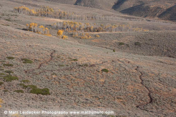

*For more detailed descriptions, topo maps, and information on the history, geology, and wildflowers of the Wood River Valley pick up a copy of Exploring Sun Valley online or find it at one of several local shops.
Photos
Hidden Valley Turns
Share on Facebook
YouTube
Facebook
Login