

STANDALONE TRAIL MAP
TRAIL INFORMATION

Mill Lake Trail #136
// track pieces: 138, // elevation pieces: 138
Details
| Status: | Open |
| Difficulty: | Intermediate |
| Uses: | Mt Biking & Hiking & Equestrian & Motorcycle & eBikes |
| Length: | 2.1 miles |
| Start: | 7,247' |
| End: | 8,242' |
| Min: | 7,183' |
| Max: | 8,281' |
| Gain: | 1,128' |
| Loss: | -132' |
| fly your trail in 3D | |
 |
Google Earth KML file
Download KML file above, open in Google Earth to see this trail in 3D! |
| don't get lost |
| GPX file (right click to download)
Download GPX file above, upload the track to your GPS or smartphone and you'll always know where you are!! |
Trailhead Forecast
Description / Access Information
Mill Lake Trail #136: In 2020 the access to the trail was moved to the trailhead at the end of Prairie Creek Road.
Mill Lake Trail is open to motorcycles and e-bikes from May 1 through Nov. 30 of each year.
The #136 Trail is a nice path to Mill Lake. The lake formed , which formed when water backing up behind a large landslide deposit. The lake's water drains directly into and beneath a half-mile of rocky debris, which explains the lack of an outlet stream. The lake slowly drains throughout the summer leaving exposed sand and mud flats for late-summer visitors. In mid-summer wildflowers along sections of the creek are often bountiful.
Directions: Head north from Ketchum on Hwy 75.. Prairie Creek Road is about 18 miles north of town. Turn left and follow the dirt Prairie Creek Road for 2.6 miles to its end at to the Prairie Creek Trailhead (2.6 mi).
For addition al information contact the Sawtooth National Recreation Area by visiting their headquarters and visitors center, which is on the east side of Hwy 75 and about 8 miles north of Ketchum. You can phone the SNRA Headquarters and Visitors Center at (208) 727-5000.
Photos
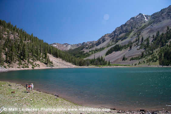 |
| Mill Lake |


