

STANDALONE TRAIL MAP
TRAIL INFORMATION

Chocolate Gulch Trail #312
// track pieces: 522, // elevation pieces: 522
Details
| Status: | Open | ||
| Difficulty: | Advanced | ||
| Uses: | Mt Biking & Hiking & Equestrian | ||
| Length: | 3.8 miles | ||
| Start: | 6,122' | ||
| End: | 6,265' | ||
| Min: | 6,107' | ||
| Max: | 6,839' | ||
| Gain: | 1,002' | ||
| Loss: | -861' | ||
|
|||
| fly your trail in 3D | |
 |
Google Earth KML file
Download KML file above, open in Google Earth to see this trail in 3D! |
| don't get lost |
| GPX file (right click to download)
Download GPX file above, upload the track to your GPS or smartphone and you'll always know where you are!! |
Trailhead Forecast
Snowfall
New Snow last 12 hours: 0.34". New Snow last 24 hours: 0.8".Description / Access Information
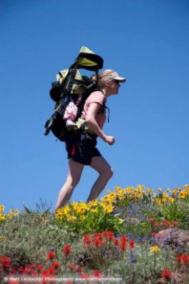
Chocolate Gulch Trail #312: This popular trail offers a great combination of mid-summer wildflowers, views of the Boulder Mountains, and a beautiful section along the Big Wood River. The best access is from the Fox Creek Trailhead.
Directions: Drive north on Highway 75 to the Fox Creek access sign (5.8 mi). Follow the road to the trailhead loop parking and picnic area (.3 mi).
*For more detailed descriptions, topo maps, and information on the history, geology, and wildflowers of the Wood River Valley pick up a copy of Exploring Sun Valley online or find it at one of several local shops.
Photos
 |
| Hiking Chocolate Gulch |


