

STANDALONE TRAIL MAP
TRAIL INFORMATION

Proctor Mountain Trail
// track pieces: 617, // elevation pieces: 617
Details
| Status: | Open |
| Difficulty: | Intermediate |
| Use: | Hiking |
| Length: | 3 miles |
| Start: | 6,098' |
| End: | 6,242' |
| Min: | 6,098' |
| Max: | 7,052' |
| Gain: | 1,133' |
| Loss: | -988' |
| fly your trail in 3D | |
 |
Google Earth KML file
Download KML file above, open in Google Earth to see this trail in 3D! |
| don't get lost |
| GPX file (right click to download)
Download GPX file above, upload the track to your GPS or smartphone and you'll always know where you are!! |
Trailhead Forecast
Snowfall
New Snow last 12 hours: 0.34". New Snow last 24 hours: 0.8".Description / Access Information
Proctor Mountain Trail: This trail is a very popular hiking and running opportunity. Hiking the main Proctor loop is around a 4 to 6 mile outing, depending on where you start and end.There are several approaches to the trail, with the Ketchum Ranger District's Trail Creek Trailhead being the recommended spot for accessing the trail. Other people prefer to start a hike on Proctor Mountain by parking at the Sun Valley Resort's Hemingway Memorial, then dropping down to cross Trail Creek to follow a trail that takes one up to the low, west end of the Proctor Trail. You can also gain this same low, west end of Proctor by parking at the end of Fairways Road in Sun Valley. Parking is very limited at the end of Fairways Road however, and everyone is encouraged to use one of the alternative parking areas/access points for Proctor, if at all possible. If you will be driving to access Proctor, please drive slowly and extra safely through any neighborhoods you pass through.
To get to the main access points for Proctor Mountain Trail, head northeast from Ketchum on Sun Valley Road. Sun Valley Road becomes Trail Creek Road at its intersection with Saddle/Dollar Road. At this traffic-light controlled intersection continue straight/northeast. From the intersection of Dollar/Saddle and Trail Creek Road it is approximately 1.6 miles to the Hemingway Memorial on the right. From the road-side parking area, take the trail in toward the memorial and carry around to continue over a small footbridge spanning an irrigation canal. Drop on the singletrack down to the floodplain and follow the signs marking the trail. After crossing Trail Creek climb up to the left on the singletrack and pass around a rocky promontory to arrive near to the intersection of trails where the Proctor Trail heads up the drainage.
If you want to accessing the trails in the vicinity of Proctor from the Trail Creek Trailhead, continue straight past the Hemingway Memorial parking area for about another mile on Trail Creek Road. Just past the entrance for the KRD's Boundary Campground, turn right into the parking area for Trail Creek Trailhead. There is an info kiosk at the parking area. There is a vault toilet at the nearby Boundary Campground. There are creekside picnic tables at the campground's picnic area and along Trail Creek Trail.
To get to the trails on Proctor from the Trail Creek Trailhead, head northeast from the trailhead along Trail Creek - on the Trail Creek Trail. In a short distance turn right to cross Trail Creek over a large metal and wood footbridge. On the opposite side continue up the singletrack trail to gain the meadow-like bench lands that are used in the winter as part of the Sun Valley Resort's Nordic trail offerings. Once up on the bench bear right and southwesterly on any of the various trails that criss-cross and meander around in the area. Work your way in the direction of Baldy, who's ski-run covered slopes are visible in the distance. You will want to stay higher on the bench-lands - you don't really want to drop back down to the level of Trail Creek. Stay more left and uphill and utilize either the Aspen Loop Trail or the service-road trails to get up onto the Proctor Loop.
Photos
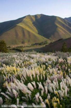 |
| Wild flowers on Proctor |


