

STANDALONE TRAIL MAP
TRAIL INFORMATION

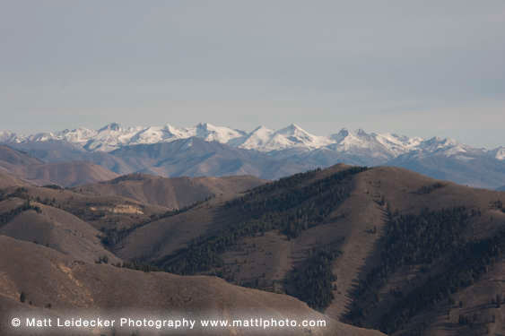
Kinsey-Curran Connector Tr. #318
// track pieces: 576, // elevation pieces: 576
Details
| Status: | Open |
| Difficulty: | Advanced |
| Uses: | Mt Biking & Hiking & Equestrian & Motorcycle & eBikes |
| Length: | 2.5 miles |
| Start: | 6,909' |
| End: | 6,409' |
| Min: | 6,409' |
| Max: | 7,537' |
| Gain: | 679' |
| Loss: | -1,181' |
| fly your trail in 3D | |
 |
Google Earth KML file
Download KML file above, open in Google Earth to see this trail in 3D! |
| don't get lost |
| GPX file (right click to download)
Download GPX file above, upload the track to your GPS or smartphone and you'll always know where you are!! |
Trail Info
REMARKS:
Trails are dry and cleared. The WRTC/KRD volunteer moto crew has been busy clearing trails this summer- a huge thank you for all their work!
August 13th Forest Service reports:
• A band is on top between Kinsey Creek and Wolftone Creek.
Trailhead Forecast
Description / Access Information
Kinsey-Curran Connector Trail #318: The #318 Trail is steep and demanding from either end, but more approachable on a bicycle from its west end. Using the Curran Trail #160 on the approach makes for a nice warm-up and a pleasant start to the climbing. Once on the #318 Connector Trail the path pitches up significantly. The trail climbs the hillside out of Curran with a number of traverses interspersed with tight switchbacks. As the trail continues to climb toward a saddle it enters a more open area. Here, the grade lessens, but the soils become softer, so it remains a grunt to the saddle.
The Kinsey-Curran Connector helps form a good hiking loop. In the fall, the color on the east side of the Curran Trail, and the gurgling of Curran Creek, help make for a great walk. The trail can be traveled in either direction, with the Kinsey side being extra direct in its alignment. There are some nice rock features on the Kinsey side that demand a high skill level for mountain bikers attempting to descend down them. Mountain bikers and motorcyclists will find that their brakes get a significant workout on this trail, so have them in good shape as you approach the ride.
For those wishing to climb up from the Kinsey side, its steep.
Be mindful that portions of your route will be through burned areas. Beware of falling trees and limbs, rolling rocks and flash floods. Watch the weather and stay out if the forecast is for stormy weather or high winds. Trees come down all the time in a burned forest, winds or not, and despite the best efforts of the FS Trail Crew, and area volunteers, some trees may be down along your intended route.
Accessing the trails in the Deer Creek drainage takes some effort. Deer Creek Road starts out pretty nice, but depending on when it was last graded, and the time of the year, it can get pretty rough. As you get deeper in, the road narrows, and there some blind corners that you need to approach slowly. It takes a while to get in and out, but if it isn't the high-summer season, or hunting season, the area can be relatively quiet, and somewhat less traveled.
Background:
During the 2013 Beaver Creek fire, over 70 percent of the Deer Creek drainage burned. This was followed by torrential storms and flooding in the spring of 2014. The resulting damage to the natural and man-made components of the drainage was stunning. The area was ravaged and required a multi-year, significant rebuilding effort by the Forest Service and the local community. From 2015 to 2018, the Ketchum Ranger District rehabilitated the floodplain, restored wildlife habitat, rebuilt 20 dispersed campsites, installed trailhead facilities at two locations, and relocated 3,500 feet of forest road. They planted over 20,000 native plants and are treating the area for noxious weeds. They also rebuilt 28 miles of single-track trails in Deer Creek. These rebuilt trails form important connections to the vast system of trails found to the north of the drainage.
In total, Deer Creek restoration costs neared $1.6 million. Funding for this massive effort was largely mobilized by the 5B Restoration Coalition, a grassroots community alliance of diverse interests that strives to bring the Wood River community together to restore and enhance our lands and natural assets. Blaine County’s Land, Water and Wildlife Program, a tax-payer levy program, contributed $496,000 to the Deer Creek restoration efforts. This significant contribution provided leverage for additional funding including $188,000 from the National Forest Foundation, who is also the facilitator of the 5B Restoration Group. For more information about the 5BRC visit this web site: 5B Restoration Coalition
Directions:
At the intersection of Hwy. 75 and Deer Creek Road, take the paved Deer Creek Road west. (This intersection is about 2 miles north of Hailey, and about 9 miles south of Ketchum). Travel safely and slowly through the neighborhood to cross the bridge over the Big Wood River. The road surface changes to gravel approx. 3 miles west of the highway.
From the highway it is about 10.5 miles out Deer Creek Road to its end at the FS Deer Creek Trailhead. The parking at the end of Deer Creek Road becomes most crowded during hunting season. At the trailhead are an interpretive/map kiosk and a vault toilet.
*For additional descriptions, maps, and information on the history, geology, and wildflowers of the Wood River Valley pick up a copy of Exploring Sun Valley online or find it at one of several local shops.
Photos
 |


