

STANDALONE TRAIL MAP
TRAIL INFORMATION

Shadyside Trail #317
// track pieces: 207, // elevation pieces: 207
Details
| Status: | Open |
| Difficulty: | Intermediate |
| Uses: | Mt Biking & Hiking & Equestrian |
| Length: | 1.64 miles |
| Start: | 5,968' |
| End: | 6,203' |
| Min: | 5,966' |
| Max: | 6,233' |
| Gain: | 377' |
| Loss: | -142' |
| fly your trail in 3D | |
 |
Google Earth KML file
Download KML file above, open in Google Earth to see this trail in 3D! |
| don't get lost |
| GPX file (right click to download)
Download GPX file above, upload the track to your GPS or smartphone and you'll always know where you are!! |
Trail Info
REMARKS:
Ketchum Ranger District reports most of the front country trails are open and cut out.
Trailhead Forecast
Description / Access Information
Shadyside Trail #317: This single-track traverse has limited climbing and offers pleasant shade in the mid-summer heat.
You can access Shadyside Trail #317 from the Adams Gulch Trailhead. To get to the trailhead follow the bike path or Highway 75 north to Adams Gulch Road. This intersection is about 0.7 miles north of the stoplight intersection of Hwy 75 and Saddle Road in Ketchum. Follow Adams Gulch Roads west as it crossed the Big Wood River and twists and turns through the neighborhood to a stop sign. Turn left at the stop sign and continue on the road to its end at the trailhead.
For more detailed descriptions, topo maps, and information on the history, geology, and wildflowers of the Wood River Valley pick up a copy of Exploring Sun Valley online or find it at one of several local shops.
Photos
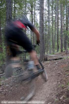 |
| In the trees on Shadyside |


