

STANDALONE TRAIL MAP
TRAIL INFORMATION

Sunnyside - Lane's Trail #316
// track pieces: 209, // elevation pieces: 209
Details
| Status: | Open |
| Difficulty: | Intermediate |
| Uses: | Mt Biking & Hiking & Equestrian |
| Length: | 2.2 miles |
| Start: | 6,204' |
| End: | 5,968' |
| Min: | 5,968' |
| Max: | 6,441' |
| Gain: | 397' |
| Loss: | -633' |
| fly your trail in 3D | |
 |
Google Earth KML file
Download KML file above, open in Google Earth to see this trail in 3D! |
| don't get lost |
| GPX file (right click to download)
Download GPX file above, upload the track to your GPS or smartphone and you'll always know where you are!! |
Trail Info
REMARKS:
Ketchum Ranger District reports most of the front country trails are open and cut out.
Trailhead Forecast
Description / Access Information
Sunnyside - Lane's Trail #316: The Sunnyside portion of this trail is named for its open, sunny aspect. It has an even more open feeling to it since burning in the 2007 Castle Rock Fire, but the aspens are making a strong comeback.
There are still many standing dead trees in the aspen groves, and they can come down at any time. Don't be surprised if you come across a downed tree or two. The trail adopters (Elephant's Perch/Lane's & Sawtooth Brewery/Sunnyside), FS Trail Crew, and BCRD Wood River Valley Trail Coordinator work to keep the trail clear and maintained. If you find a downed tree across the trail please report its size and location to the adopter, the Ketchum Ranger District, or the BCRD Wood River Valley Trail Coordinator.
The Lane's Trail portion of Trail #316 is named after local skier Lane Parrish who died in a tragic small plane accident in 1990. This trail weaves in and out of sage-covered gullies to a memorial picnic table before descending to the Citizen’s Trail junction, and beyond to its intersection with the Old Adams Gulch Road Trail #142. In the spring the area lights up with blooming arrowleaf balsamroot and lupine.
Because of its proximity to Ketchum, concentrated network of excellent trails, and multiple access points, Adams Gulch is easily the most popular hiking and biking destination in the Wood River Valley. There are many hiking options and the trails connect to the Fox/Chocolate/Oregon trails making it possible to link together longer day hikes and mountain bike rides.
You can access the Sunnyside-Lane's Trail #316 from the Adams Gulch Trailhead. To get to the trailhead follow the bike path or Highway 75 north to Adams Gulch Road. This intersection is about 0.7 miles north of the stoplight intersection of Hwy 75 and Saddle Road in Ketchum. Follow Adams Gulch Roads west as it crossed the Big Wood River and twists and turns through the neighborhood to a stop sign. Turn left at the stop sign and continue on the road to its end at the trailhead.
For more detailed descriptions, topo maps, and information on the history, geology, and wildflowers of the Wood River Valley pick up a copy of Exploring Sun Valley online or find it at one of several local shops.
Photos
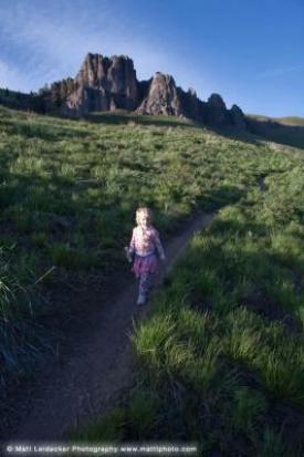 |
| Hiking Lane's Trail |


